Geography and California Indians Before Spanish Influence
California geography: California’s vast regions all have distinctive histories. Long ago, before the Europeans discovered America, indigenous people inhabited the land. Prior to Spanish contact an estimated 310,000 Native Americans lived in the boundaries of what is now known as California. Native California culture was shaped by the climate they lived in and the geography they were bound by, each society developing its own unique identity to enrich the region creating complex civilizations.
158,695 square miles of mountains, valleys, deserts, beaches, and forests make up what is known as California. Each region boasts unique plant and animal life, climates, and topography. 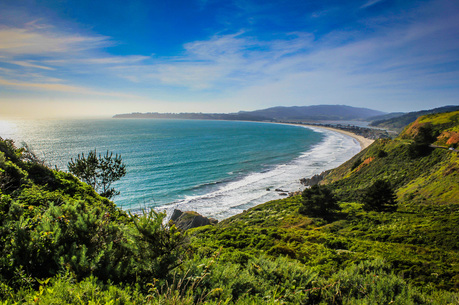
|
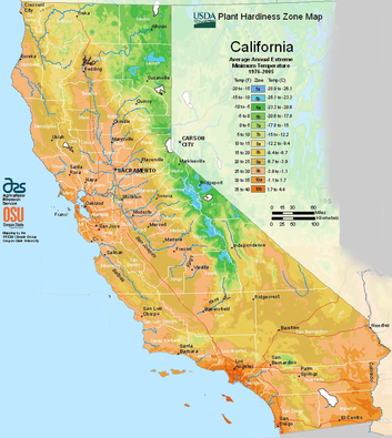
General map of California regions and climates.
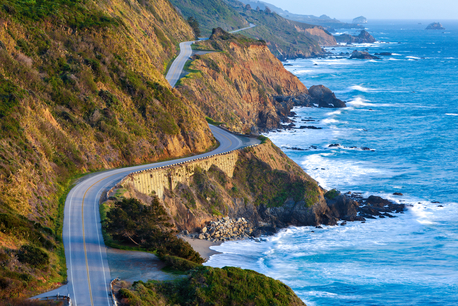
Coastal regions: California’s costal regions are immense, “fronting more than half the shoreline of the Western Continental United States of America, California – all 158,695 square feet of it – offers clear-cut topographies.” (Star 7) The 1,264-mile Pacific shoreline was formed over thirty million year ago when two tectonic plates separated. Along the gigantic shoreline four natural harbors can be found. San Diego, San Francisco, Monterey, and Humboldt Bay’s are the four natural harbors on the California coast. San Francisco Bay is one of the world’s finest natural harbors on Earth. Hundreds of years ago San Francisco Bay was used by the Native California Indians for food and transportation, today San Francisco bay is one of the busiest trade ports on the planet. Southern California’s sandy beaches were formed over millions of years. Originally, Southern California’s coast was predominately large rocks and steep cliffs. Eroded from the Santa Monica Mountains each speck of sand found on the beach today tells a long story. Starting as large boulders the rocky mountain’s rocks tumbled down and broke into smaller parts. When the rocks reached rivers and
|
streams, the water carried the shrinking rocks to the oceans shore. Over time the rock fragments accumulated and became sand. The beach cities to the South of California host a Mediterranean climate characterized by a hot, dry summers and cold, sometimes wet winters. In comparison Northern California is characterized by gloomy rainy weather that lasts most of the year.
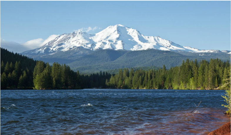
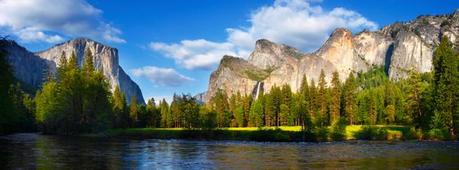
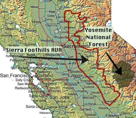
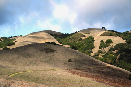
mountains and forests: Northern California’s geography ranges from sandy and/ or rocky beaches to snow capped mountains. The Sierra Nevada mountain range runs four hundred miles north south, seventy miles east west, and stand 14,505 feet tall at its peak; it is the highest peek in the continental United States. Adjacent to the tallest peak, Yosemite Valley features a granite gorge carved by a moving glacier. The valley is nearly one vertical mile high with a dense forest along the eight-mile wide valley floor, which also has a multitude of rivers, streams, and waterfalls including Illilouette and Tenaya. Yosemite valley is home to the largest waterfall in North America. The Sierra Nevada mountain range’s climate is influenced by the Mediterranean climate of Southern California. The Sierra Nevada’s receive twenty to eighty inches of precipitation annually. Because rainfall is more common in the North/ North West Areas of California, redwoods and other indigenous trees and plants are found in California’s temperate rainforest.
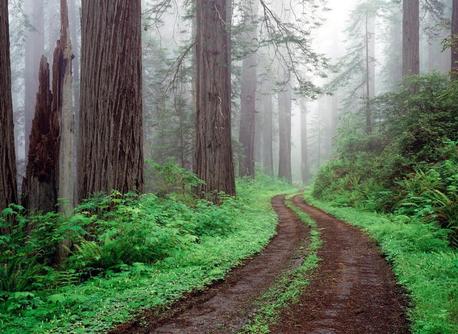
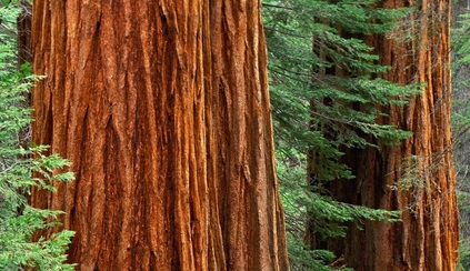
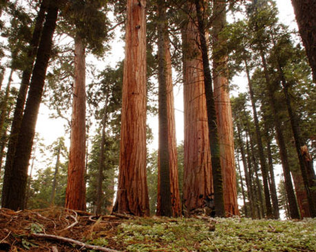
The city of Gasquet in the upper most left corner of California receives the most rainfall, approximately ninety-five inches, each year because it is a part of California’s temperate rainforest. The rainforest of California is home to many types of trees including the giant sequoias and redwood trees. Reaching 379 feet high the world’s tallest living tree calls California’s Redwood National Park home. The trees indigenous to this area range in age from 1,200 and 1,800 (or more) years old and have a diameter that can reach up to 27 feet thick. |
|
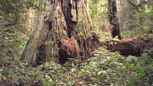
Over 200 exotic species are known to inhabit Redwood Nation Park; these include English ivy, spotted knapweed, and poison hemlock. California is a hotbed of seismic activity. Northern California experiences minor trembles on a daily basis, and larger quakes rarely. Large earthquakes, above a 5.0 on the Richter scale, have shifted the land enough to offset rivers, facilitate landslides, and erode the cliffs on the shore. Most rocks found in Northern California are sedimentary rocks that formed deep in the ocean. These rocks were elevated from the ocean floor millions of years ago and are part of the Franciscan Assemblage. Sandstone, siltstone, and shale are common rocks formed through sedimentation on the ocean floor. As the name suggests, there is plenty of rain in the rainforest in California. Rainfall of twenty-five to one hundred and twenty-two inches falls during the fall, winter, and spring seasons. The trees continue to receive hydration during the summer months through thick coastal fog.
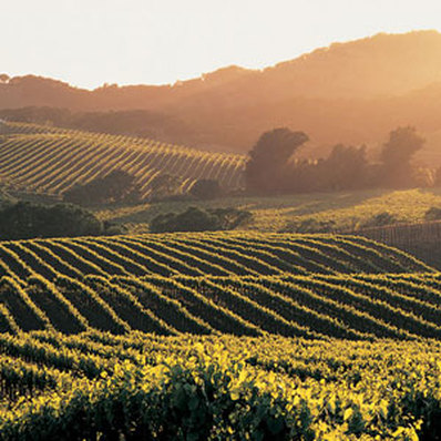
Foothill and valley regions: The foothills in the San Gabriel valley region are comprised of six distinctive landmasses. Puente, San Jose, San Rafael and South Hills along with the San Gabriel Mountains and Verdugo Mountains make up what is known as California’s foothills. Although the foothills share California’s coastal Mediterranean climate, wild fire dangers are high. When the air in Southern California becomes warm and dry and the indigenous plants become dry from lack of moisture the region becomes a wild fire time bomb.
|
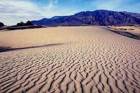
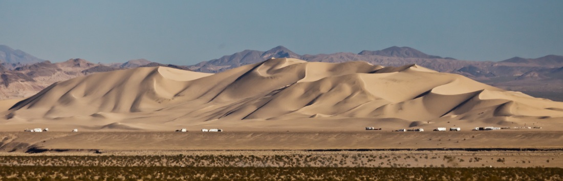
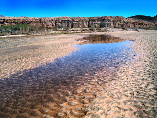
Mohave desert region: Drastically different in comparison, California’s desert regions receive very little rainfall. The Mojave Desert, which receives less than 13 inches of rainfall annually, in Eastern California is known as a high desert, but also hosts the lowest point in North America. Death Valley holds the record for the hottest reported temperature- 134 degrees –recorded July 10, 1913. Mojave desert in total spans 47,877 square miles with the majority of the desert falling within California’s borders. Three lakes can be found in the desert wasteland Lake Havasu, Lake Mead, and Lake Mojave. Along with the three lakes various streams can be found forging their path through the desert as well as the Colorado River.
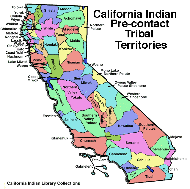
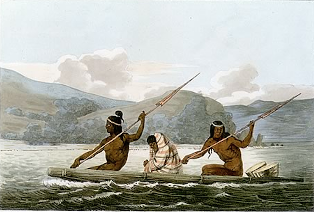
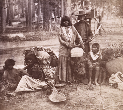
topography and travel/ trade: The sweeping differences in topography found throughout California made life additionally difficult for the Native California people. Each tribe was separated from others by mountains, rivers, hills, deserts, etc. making trade, travel, and prosperity tremendously difficult. “California’s Native Americans did not organize into large tribes like the rest of the North American tribes. Instead they divided into groups, or tribelets” (Boulé- Coastal Miwok 4.) Coastal tribes had access to goods, like fish and shells, which other tribes did not. The Coastal Miwok tribe consisted of many small villages, which worked together for their own tribe. Each tribe was careful to respect the boundaries between their land and others. Most boundaries were easily recognizable. The boundary line would fall next to rivers, mountains, or painted tribal poles. The Coastal Miwok tribe lived just north of what is now San Francisco in Sonoma. The small tribe of 2,000 members territory covered the shore or the Pacific Ocean, the bays, lagoons, and marshlands, and the cliff top bluffs overlooking the ocean with some inland areas as well. Their permanent settlements were usually found along fresh water springs and near the ocean, however during the summer months the Miwok tribes men and women moved to the low foothills to gather food and hunt for the things they would need to survive the winter. The Coastal Miwok tribes used money for everything. The tribes string money was made using small similarly sized beads made with broken pieces of clamshell places on a vegetable fiber cord (Boulé- Coastal Miwok 29.) The tribe preferred to trade amongst its own people, not with other tribes. When necessary they tribal leaders traded for obsidian, deer, and knife blades with the nearby Pomo tribe to the North and yellow body paint from the Wappo tribe to the North East. The tribe had no reason to trade; they had access to fish, deer, and crab year round. Hunters were given distinct diets for two days prior to leaving on a hunt. The tribe believed it would bring the huntsman luck, so he would not need to hunt outside the tribe’s territory.
|
Mohave desert: While the Miwok tribe was fortunate enough to have access to plenty of food and water, the Mohave tribe was not. The tribe’s territory was in the western desert along the Colorado River. Mohave’s people were known to be warriors, fishermen and farmers. Yearly flooding provided the soil with enough nurturance to last year round; this provided the tribe the means to farm more that fifty percent of their needed food. Forty or fifty of the tribe’s men were tasked with war and their every thought involved protecting the tribe’s people in their three territories. Of the three territories –northern, southern, and middle areas- the tribe members were allowed to travel freely. Because the Mohave tribe had lands on both sides of the Colorado River, they used pots, pans and rafts to transport goods. Usually the tribe members would swim through the river pushing the goods in front of them. “Mohave people believed Mesquite to be the ‘tree of life.’ Fresh beans gave juice for the natives to drink. Ground mesquite was used to make mush and cakes” (Boulé – Mohave Tribe 37.) Mohave people were not bothered by the tremendous geographical boundaries that separated the California tribes. The Mohave tribe’s people traded with other tribes such as the Gabrielińo who lived on the coast of California over 250 miles away.
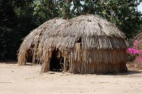
Rainforests: The rainforests of Northern California hosted many indigenous people. Tolowa, Yurok, Karok, Shasta, Yuki, and Hupa Tribes all fall in the boundaries of the Temperate Rainforest environment. Near a narrow band of Redwood trees on low hilly land the Tolowa tribe of 300 or so people settled. This indigenous tribe stayed inside their houses for most of the year. The rainy weather prevented hunting, gathering, and fishing all year round, however in August the tribe traveled inland to fish for salmon and gather acorns. Redwood trees provided the base for their buildings, homes, and boats. It can be inferred that the Tolowa tribe traded their fish, shells, and other goods for the rocks, minerals, and animal hides they needed.
|
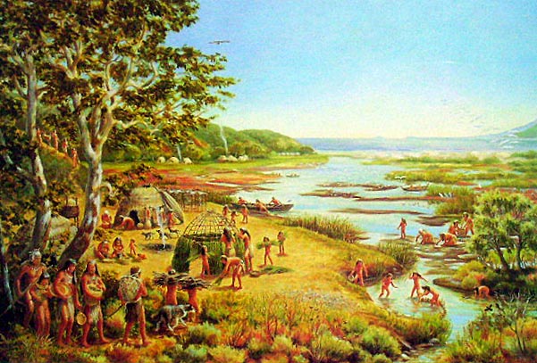
Gabrielino tribe: The richest, largest, and most powerful tribe in California was the Gabrielino tribe. Gabrielińo’s called the Los Angeles and Orange County areas home. These areas included mountain and foothills, prairies, exposed and sheltered coasts. Because the territory was so expansive the Gabrielińo’s had many different villages each with their own chief. Similarly to the Miwok tribe, the Gabrielino tribe fished and hunter the local deer, rabbits, and occasionally mountain lions. The tribe had a monopoly on the soapstone market. All other tribes in California needed the stone. Fortunately for the Gabrielino tribe it could only be found on Catalina Island, which fell in the Gabrielino territory. The Southern Californian Mediterranean climate made life easy for the tribe with sunny and warm weather most of the year.
|
Foothill and valley tribes:
“The Foothill Yokut Tribe was a group of fifteen triblets. Its territory stood along the western slopes of the Sierra Nevada Mountains.” (Boulé – Foothill Yokut Tribe 26) The triblets are positioned in valleys or the foothills near streams and creeks. “Men spent their days making and repairing hunting and fishing tools.” (Boulé 30) Women stayed near their home and attended to their children and the daily meals. Families were named after animals found near by to help keep track of family lineage; certain families were more affluent than other, and the chief was always of Eagle family descent. The mountain and valley tribes seldom had to travel outside of their tribe for food. On the rare occasion the tribe would need to travel for food, they would travel on foot with heavy loads of food and belongings strapped to women’s backs. Traveling outside the Yokut territory was harsh because the tribe’s settlements were usually 6,000 feet up the mountain.
The different topographies of California shaped the way indigenous California people lived their lives. Some tribes had access to fish and shells others had access to farm land an mesquite beans. The tribes, when not at war, worked together to thrive in their various climates and landscapes. Before the Spanish missionaries colonized California, the native people had their own unique civilizations.
The different topographies of California shaped the way indigenous California people lived their lives. Some tribes had access to fish and shells others had access to farm land an mesquite beans. The tribes, when not at war, worked together to thrive in their various climates and landscapes. Before the Spanish missionaries colonized California, the native people had their own unique civilizations.
Discussion Questions
USE INFORMATION FROM THIS AND OTHER TABS TO BEST ANSWER THE FOLLOWING QUESTION
1.) there were approximately 310,000 native california indians before the spanish contact (before the missions were built), do you think the indigenous populations grew or shrunk after the spanish influence reached the tribes.
2.) which tribes population was the largest? Why? DO you think the particular tribe was the most dominant fighters as well to protect their claim?
3.) how many miles of ocean coast does California host?
Works Cited:
Boulé, Mary Null., and Daniel Liddell. Coast Miwok Tribe. Vashon, WA: Merryant Pub., 1992. Print.
Boulé, Mary Null., and Daniel Liddell. Foothill Yokut Tribe. Vashon, WA: Merryant Pub., 1992. Print.
Boulé, Mary Null., and Daniel Liddell. Gabrielino Tribe. Vashon, WA: Merryant Pub., 1992. Print.
Boulé, Mary Null., and Daniel Liddell. Mohave Tribe. Vashon, WA: Merryant Pub., 2000. Print.
Boulé, Mary Null., and Daniel Liddell. Tolowa Tribe. Vashon, WA: Merryant Pub., 1992. Print.
Ebner, Matthew. Geography of California. El Camino Community College. 2013. Lecture.
Herzig, Chuck. Geology of California. El Camino Community College. 2014. Lecture
Starr, Kevin. California: A History. New York: Modern Library, 2005. Print.
